In the heart of Bloomsbury, deep in the bowels of the UCL geography department, down corridors floored in institutional linoleum, sticky and scuffed by generations of students, is a room full of maps. Hundreds of thousands stacked on top of each other, tidied away in sliding wooden drawers that march to the ceiling. But not only maps: there are shelves groaning with atlases, guidebooks and Baedeckers; an entire annexe given over to hundreds of wall charts. In fact, almost every conceivable way you might orient yourself on the globe, or make legible any geographical phenomenon on paper, is represented here. It’s a cartophile’s delight; an obsessive compulsive’s nightmare.
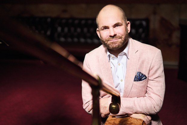
The keeper of this horde – strictly speaking, the UCL Map Library – is James Cheshire, Britain’s only professor of cartography. With his neat, trimmed beard and steady gaze behind thick-rimmed glasses, he looks every inch the scholar-explorer – stick him in puttees, and pop a pith helmet on his head, and he might have stepped out of a H. Rider Haggard novel.
Cheshire first became aware of UCL’s Map Library while he was finishing his PhD. But he only began seriously rooting about inside it a few years ago. What he found entranced – and appalled – him. Once, almost every university geography department in the country had a facility like it. Now, UCL’s is one of the few remaining, and it had essentially been abandoned since its long-time librarian, Anne Oxenham, retired in 2001. By the time Cheshire came to it, its vast corpus of material was all-but-uncategorised. He sought to bring some order to the chaos.
‘It was quite the feat of endurance,’ he tells me. With the help of some of his students, he started to sort the collection. His favoured method was to mount a ladder, wodge his arms around a shelf of material in a drawer, jump and let fly: the older maps, typically printed on heavier, better-quality paper would thump straight down, while more recent reprints would snowstorm across the room. He expected to discard the majority of what he found. Instead, he found himself in possession of a unique archive – a place that charts a discipline that finds itself right at the centre of things once again.
Put simply: maps are back. After all, few tools are as useful to a strongman leader. Putin’s foreign policy can partly be understood as an attempt to make real the hazy notion of Russkiy mir: a map of the greater ‘Russian world’ that Putin argues encompasses Ukraine and the Baltic states. In direct rebuttal to this, Ukrainian colleagues gifted Cheshire a tourist map of Zaporizhzhia: a defiant statement that, one day, their city will welcome visitors again. In August, meanwhile, Google renamed Lake Ontario ‘Lake America’ after an executive order signed by Donald Trump came into force. ‘Cartographers have this phrase: “The map is not the territory,”’ says Cheshire. ‘Well, in Trump’s mind, the map is the territory.’
Modern cartographic mania strays into absurdity, too. The 2023 Barbie film got into hot water when, in a brief scene, Margot Robbie’s Barbie stands in front of a map of the world. This cartoonish representation shows Asia as a blue splodge (illustrated by a jovial turtle), with eight dashes coming off it and advancing into the sea. For lawmakers in Southeast Asia this squiggle looked uncomfortably close to the ‘nine-dash’ line that China uses to assert its territorial claims in the South China Sea. The map was blurred in screenings in the Philippines and the film was banned outright in Vietnam. Not to be outdone by a plastic doll in tackling the weighty issues of the day, the UN General Assembly voted earlier this month to ditch the 16th-century Mercator projection world map in favour of an ‘equal earth’ visualisation that gives greater prominence to Africa. This ‘Correct the Map’ resolution was sponsored by Togo and passed with the support of 164 nations.
There is an idea among some that maps are irredeemably colonialist inventions. Certainly, many of the maps in UCL’s collection come from the great age of Victorian exploration. As sponsored by bodies such as the East India Company, they were undoubtedly both instruments of understanding and curiosity and also exploitation and control. A notorious example – as Cheshire points out in his 2025 book about the Map Library, The Library of Lost Maps – are the ‘Mountains of Kong’. First charted by the explorer Mungo Park in the 1790s, this massive range of peaks stretched across central Africa and appeared on numerous maps through the years, making a final entry in the index of The Oxford Advanced Atlas, published in 1936. The Mountains of Kong, of course, never existed.
‘Maps have been complicit in some of the most harrowing events in history,’ Cheshire reflects. ‘But they’ve also done a huge amount of good. They can always have a dual purpose – a map of virgin rainforest, for instance, could be amazing for conservation. But it would also be very handy for a logging company.’
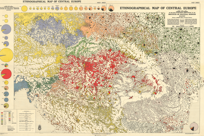
Nothing illustrates the Janus-faced nature of maps like war. And the UCL Map Library has played a defining part in both world wars. At the Treaty of Versailles, one of its pioneering geographers, Lionel Lyde, produced a series of naval intelligence booklets to inform the redrawing of postwar European borders. Layering geographic and sociological information – from mountain ranges and rivers to ethnicity and religious affiliation – they sought to compress an impossible density of data within their pages. This led to some confusion. The diplomat Howard Nicholson recorded in his diary that, on one occasion, David Lloyd George was appalled that a map of Turkey’s Levantine coast was seemingly ‘full of Greeks!’ Nicholson gently bent down to whisper in the Prime Minister’s ear that he had mistaken it for an ethnographic map – and that the pesky Greeks were in fact valleys.
Many of the tensions of the interwar years were driven by maps. In the 1920s, the German cartographer Karl Haushofer coined the idea of ‘suggestive cartography’. He argued that maps could represent aspirations as well as facts – and that they could be used to challenge what he saw as the unequal division of Europe after Versailles. Haushofer’s ideas became hugely influential. Among those who absorbed his theories were Rudolf Hess and Adolf Hitler, whom Haushofer personally tutored while they were serving sentences in Landsberg Prison for the 1923 Beer Hall Putsch.
After the outbreak of war, many UCL staff were drafted into intelligence roles. Geographers who spent their careers studying Germany now found their knowledge turned to directing bombing raids, targeting places they’d lived in, and people they had worked alongside. The war became a struggle for cartographic as well as military might. As the Allies pushed into Europe, they acquired vast quantities of captured German maps. Led by the Office of Strategic Services (the precursor to the CIA), one haul in Bamberg saw 90 tons of maps shipped back to Washington – printed on flimsy wartime paper, this equated to more than 100,000 maps.
But the Allies weren’t simply interested in physical maps; they wanted the minds that went into making them too. So, as Hitler’s regime collapsed, UCL academics were sent to interrogate captured German geographers. In many cases, the UCL mapmakers sat opposite men they had known for decades: collaborators, colleagues, friends. In fact, some German geographers were seen as so significant that they were offered shelter in the West after the war, in an equivalent scheme to Operation Paperclip that recruited Nazi scientists to combat Soviet advances. In the Map Library, for instance, there is a 1950s atlas of disease produced by Dr Friedrich Burgdörfer, an intellectual architect of Nazi eugenicism. Though it was immaculately produced, it was poorly reviewed: delayed justice for his crimes, believes Cheshire.
The UCL Map Library has played a defining part in both world wars
‘A lot of material in the Map Library comes from that period at the end of the second world war. But for decades afterwards, no one really talked about what happened. Geopolitics was a banned subject.’
Today, he says, cartographers can’t ignore the fact that geopolitics has returned with a vengeance. ‘As a map-maker, what I teach my students is that maps are uniquely powerful things, and you have a lot of responsibility when you create them. When you make them, you need to play things forward – how might this map be used in the future? How might it be misinterpreted?’
In the meantime, he’s fighting to preserve the Map Library. ‘Some of my students have never even held a paper map. What we forget when looking at a map on a phone screen is how big physical maps are – you can lean over them, trace routes. They give you a god-like view on the world.’
One of my favourite maps in the Library is a 1957 map of Mount Everest and its surroundings. It’s a gorgeous thing: a vast, vertigo-inducing canvas that peers down at the ridges, glaciers and summits of the highest mountains on Earth. Compiled by the 1955 International Himalayan Expedition, it took months of surveying to complete in the harshest conditions imagineable. When the expedition returned home, it was believed to be a failure as it hadn’t achieved its stated goal of climbing Mount Lhotse. Yet you can feel the chill of those high peaks blowing off the extraordinary artefact the expedition created.
Every one of the maps in the Map Library is the work of hundreds of hours of unsung labour, the work of numberless forgotten hands. Torn, tatty and dog-eared, they are nonetheless tangible testaments to human intellect, effort, care and love. Cheshire hopes to share that love by using some of the Library’s possessions as the centrepiece for a proposed new museum of maps – as yet, none exists in the UK.
I ask about the future of the Map Library and its treasures – gorgeous, troublesome, entirely unique. He grins and looks around, taking in the mounting ranks of wooden drawers. ‘Well, that all depends on how well people like me can answer the question: “Why is this worth saving?”’
Got something to add? Join the discussion and comment below.
You might disagree with half of it, but you’ll enjoy reading all of it. Try your first month for free, then just $2 a week for the remainder of your first year.