India started to pull away from Antarctica 132 million years ago and 112 million years ago India fully detached from Antarctica and began its northward drift. The subcontinent cruised across the Indian Ocean at 15 to 20 centimetres per year and collided with the Asian landmass 55 million years ago. The northward drift of the subcontinent then slowed to five centimetres per year.
Some 40 million years ago India and Eurasia were glued together. Both continental plates were thick and buoyant, neither could sink and so the land buckled and was uplifted. Some 25 million years ago the Himalayas and the Tibetan Plateau formed from this continental collision.
The Petermann Ranges in central Australia are the roots of a Himalayan-type mountain range planed down 10 kilometres. They formed by collision of two continental land masses around 550 million years ago. The mountains continually rose as they were scoured of soil and rock and only the deep cooked-up root of this ancient Himalayan-type mountain range remains. Long-term weathering and erosion reduced the high mountains to hills. This resulted in the removal of sand and silt to form thick layers of sediments in nearby basins. These became rocks 400 million years ago which were folded by compression to their current near-vertical position 350 million years ago. There was then a long period of weathering and erosion which left the harder remnants such as Ayers Rock and the Olgas.
India is still charging northwards at four to five centimetres a year, the Himalayas are concurrently rising and being eroded with the total elevation increase of about one centimetre a year. If you are ever asked the elevation of Mount Everest in one of those asinine trivia programs, the only answer is: When? Mount Everest has been rising for the last 25 million years and is currently 8,849 metres above sea level. It continues to rise and eventually will be flattened to the topography of the Petermann Ranges. Don’t wait up.
Marine fossils occur in 450-million-year-old limestone on the summit of Mount Everest. This creates problems for creationists who want their 6,000-year-old Earth to have been covered by a global flood 4,000 years ago during which time all fossils formed. This would mean that the Himalayas rose at 2.2 metres per year every year for the last 4,000 years. Surely someone would have noticed the land surface rising and continual catastrophic earthquakes?
The theoretical maximum elevation of a mountain range on Earth is between 8,000 and 10,000 metres above sea level because there is a dynamic gravitational balance between the tectonic uplift due to India colliding with Eurasia; erosion from landslides, glaciers and rivers; and gravity resulting in crustal sinking and the lateral spreading of molten rocks at great depth under high heat and pressure in the core of the mountains. Gravity pulls the Himalayas down due to their own weight and the mountains have deep roots into the Earth’s mantle. We have known this since the British East India Company conducted the Great Trigonometrical Survey of India between 1802 and 1870.
Above the snowline, glaciers carve out valleys into which mountains collapse. This erosion is faster than tectonic uplift hence mountains are rarely more than 1,500 metres above the snowline. In dry times, mountains grow because there is not enough water for glaciers and active river systems whereas in wetter times the rate of erosion is far higher and mountain masses are reduced. The highest mountain on Mars, Olympus Mons, is almost three times as high as Mount Everest because there is less gravity and no liquid water on Mars.
Landslides and downslope slumps are the major method of shifting masses of material during erosion, a process that has been taking place since the first rain more than 4,000 million years ago. Not a day goes by when steep, high-relief mountains at the maximum angle of repose don’t have landslides. For example, between 2004 and 2016, there were 4,862 major landslides that killed 56,000 people globally as well as destroying agricultural and grazing lands, infrastructure and livestock.
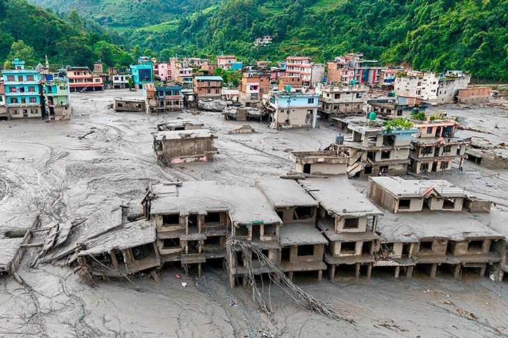
In 2024, there were more than 150 fatal landslides along the leading edge of the Himalayas. Most landslides occur in spring, summer and autumn where there is more surface water percolating through bedrock lowering friction, changing the angle of repose and exacerbating gravitational collapse. In autumn as water in cracks freezes, it expands which commonly results in the detachment of fractured rock. These landslides and associated flash floods have been occurring throughout history as an annual tragedy. Landslides are seasonal and unrelated to climate change. Landslides have nothing to do with human emissions of carbon dioxide. They are due to gravity and are assisted by frictional decrease of rocks and detritus due to water, and triggered by earthquakes, wind, thunder, avalanches and other landslides.
After heavy snow falls, such as Nepal experienced in November 2025, glaciers are loaded and gravitationally move downslope. The toe of the glacier can calve, create a debris flow of ice and rock debris and can dam rivers or catastrophically empty meltwater dams. When glaciers retreat, they leave a wall of debris of rocks, gravel and soil scraped from higher elevations that acts as a dam wall for glacial meltwaters. These dams are breached by water load, avalanches, collapsed ice and landslides to create flash flooding.
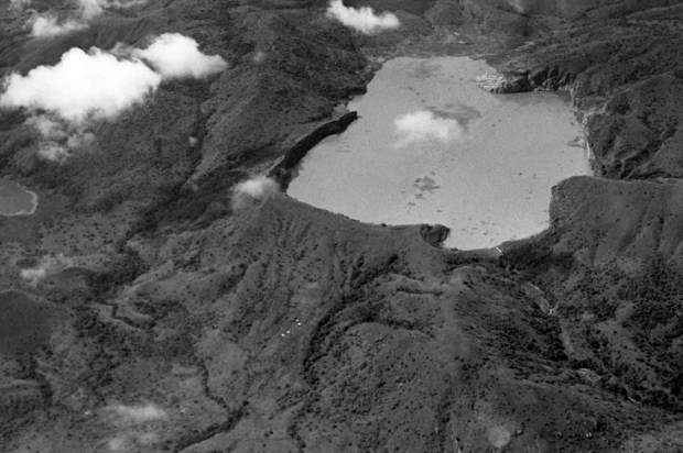
Observation of the Nepalese rivers in ravines shows large boulders which were transported downstream by regular catastrophic floods. The Nepalese flood of 2026 was larger than the 2025 flood and is part of the natural rock cycle of weathering, erosion, gravitational slumping of land masses and flooding in deeply incised alpine areas. In 1190 AD, the volume of debris from the partial collapse of Annapurna IV was 1,000 times greater than the recent landslide in Nepal. Pokhara, the second biggest city in Nepal, is built on this landslide debris. Massive landslides and flooding have occurred before and will occur again.
During my time in underground mines, the rocks talk. The unnerving cracking, hissing and bangs underground are due to de-stressing because openings had been made in solid rocks and rock pressure tried to close the space. At times in deep mines there are rock explosions and falls of rock that can be fatal. I have felt Richter magnitude 4.3 earthquakes at the surface when rocks 900 metres below broke and heaved into open space. Major deep mines in Australia have a seismic array that measures rock stresses, de-stressing and detachment. The seismic signals for stress accumulation, de-stressing, blasting, natural earth tremors and thunder are all different. These data are used as an early warning for catastrophic de-stressing and the resultant underground collapse of rocks.
Now there are also claims that US and UN aid funds were used to address mythical climate change issues, rather than providing tried-and-proven safety warning systems using seismic arrays in an area that has been undergoing active mountain-building, earthquakes, landslides and glacial collapse for millions of years. You can’t make it up.
Got something to add? Join the discussion and comment below.
You might disagree with half of it, but you’ll enjoy reading all of it. Try your first month for free, then just $2 a week for the remainder of your first year.