When staggering around the house between brushing my teeth, blankly staring at walls, and placing my morning coffee on kitchen tiles, I think about sand.
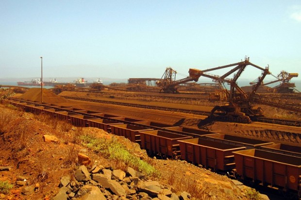
Titanium oxide pigment is produced from heavy minerals in beach sands and used in toothpaste, paints, paper, cosmetics, and medicines because it is brilliant white and inert. Since 1934, Australia has been a major producer of rutile (titanium oxide) and ilmenite (iron titanium oxide). Australian ilmenite is exported or chemically converted to synthetic rutile in Western Australia. Decades ago, the white pigment used in paints, the lead carbonate mineral cerussite, was substituted by rutile because lead was absorbed into the body causing brain damage.
(Note to critics: For a long time, I lived and worked in the lead-mining town Broken Hill.)
In the late 19th Century, more than a tonne of gold was recovered by sluicing beach sands on the north coast of NSW. These sands contain other heavy minerals such as rutile, ilmenite, zircon (zirconium silicate), platinum, cassiterite (tin oxide), monazite (rare earth phosphate), magnetite (magnetic iron oxide), garnet, sapphire, and diamond. Small amounts of monazite were sold as a light rare earth mineral whereas faintly radioactive monazite with other trash minerals were dumped back in the sand mining pit.
The northern NSW beach sands were transported down the big rivers from the weathering and erosion of granites in the New England hinterland, then moved along the coast by longshore currents and were deposited by storms on beaches during the last interglacial (the Eemian) when sea level was higher than now.
The formation of heavy mineral sands is not restricted to the Eemian interglacial. The 7.2 to 5.0-million-year-old heavy mineral beach sands 500 kilometres inland and up to 65 metres above sea level are currently mined at Pooncarie (NSW) from some of the hundreds of old beaches recognised in the Murray Basin. Large ultra fine-grained unmined light rare earth-bearing mineral sand deposits are in prime agricultural land in the Mallee and Wimmera of Victoria. Unless land level rise and fall are measured, any mention of sea level rise is baseless scaremongering.
The last interglacial 130,000 to 115,000 years ago peaked 128,000 to 125,000 years ago. Sea level was up to 9 metres higher than now. This time of high sea level was when storms threw sediment onto beaches, winnowed off the lighter quartz, clay, and shell grit and left strandlines rich in heavy minerals. Australian Eemian coastal heavy mineral beach sand deposits are inland and well above the current sea level. In Europe, shallow warm marine Eemian sediments with calcium carbonate shell fossils were deposited on top of glacial debris. The chemical fingerprint in these fossils is used to calculate temperature which, in the Arctic, was up to 4 degrees warmer than now.
During the Eemian, Scandinavia and much of the Arctic were ice-free. Horses, bison, elephants, rhinos, lions, and cave bears roamed Europe and the early humans enjoyed a genetic change. Much of what is now tundra was forested. The Eemian was one of the warmest periods for nearly a million years. It was warmer than now and there were short sharp cold spells. Human emissions of carbon dioxide clearly did not drive the Eemian warming so why should it drive the current warming? But what would we geologists know about climate?
When the last glaciation commenced 115,000 years ago, terrestrial ice sheets and sea ice expanded, sea level fell and heavy mineral beach sand deposits were left stranded inland and were shifted around by strong winds. The planet had less precipitation and the incidence and intensity of dust storms increased, deserts expanded, forests and grasslands were covered by ice, stressed animals migrated, some hominid species became extinct and we very nearly joined them when humans were reduced to about 4,000 breeding pairs around 73,000 years ago by a coincidence of a long-term orbital cooling trend and a massive explosive equatorial volcano. The temperature was up to 6 degrees cooler than now.
During glaciation, sea level fell by at least 125 metres. Japan was joined to south-east Asia; the Australian mainland, Tasmania, and Papua New Guinea were part of a landmass called Sahul; north-east Asia and North America were joined with the Bering land bridge and the English Channel did not exist. Coastal harbours and lakes in Australia were river systems and the shoreline had moved seawards.
Between 60,000 and 40,000 years ago, Australia was far drier than today. It was cold, dry, and windy 30,000 years ago with even more intense cold from 25,000 to 15,000 years ago with temperature 6 to 10 degrees cooler than now, inland lakes evaporated and sand dunes migrated. Tasmania was covered with ice and glaciers carved valleys in the Snowy Mountains.
Temperature started to rise at the start of the current interglacial about 15,000 years ago, ice retreated, inland and coastal lakes filled and, 8,000 to 5,000 years ago, Australia was warmer than now with sea level 2 metres higher than at present. Sydney, Adelaide, and Brisbane airports were then under water and Pacific coast beaches migrated westwards. A brief cold snap followed, and glaciers reappeared in the Snowy Mountains, only to disappear when there was renewed warming.
During these warmings and coolings, inland lakes evaporated and filled; the 180 estuaries, lagoons and lakes in coastal NSW opened and closed; river valleys such as Sydney Harbour, Broken Bay, and Lake Macquarie were drowned; a string of islands from Manly to Barrenjoey were joined by sand spits; old dunes containing heavy mineral sands were covered and stabilised; the human population of Australia changed vegetation and fauna with fire and hunting and human settlement changed the landscape and increased the rate of lake sedimentation.
Climate change is not occurring just because you happen to be alive. Climate has always changed and previous climate changes were not due to atmospheric carbon dioxide.
How do we know the history of sand? Solar radiation is absorbed in quartz. When quartz is heated it luminesces and the length of time of quartz exposure to sunlight can be calculated from the amount of light emitted during heating. Amino acid in bits of organic material in sediments change from the D form to the L form after death and the proportion forms can be used to give the time of death. Nuclear fallout has left a blanket of caesium 137 in sediments which can be used to measure the rates of erosion and sedimentation since 1945.
Kitchen tiles are glazed with zircon, a refractory mineral. The radioactive decay of traces of uranium in zircon can determine the time of freezing of a molten rock, which after weathering, erosion, sedimentation, lithification, burial and reheating, produces a zircon rim around an older zircon giving the geological history of the grain. The provenance of a zircon grain can also be deduced. Zircons from Pooncarie heavy mineral sands are hundreds of millions to billions of years old and derive from the central western NSW, the Musgrave Ranges and Antarctica. The 4,404-million-year-old zircon grains from Jack Hills (WA) are the oldest Earth materials discovered and may indicate liquid water was present on early Earth.
A grain of sand has many stories to tell. Show some respect.