When they erect a huge monument to the coal pioneers of the Bowen Basin, three groups must be prominent:
- The coal and coke pioneers at Collinsville, Scottville, and Bowen.
- Les Thiess, his brothers, and his faithful accountant, Don Argent.
- Utah Development Company – Ralph Long, Ted Milligan, and Tim Winterer.
The Collinsville people pioneered several things, some good, some bad. Government geologists Robert Logan Jack and Richard Daintree reported on coal in Pelican Creek near Collinsville as early as 1866 and also reported on gold, silver, sapphires, tin, and the artesian waters. Coal mining started at Collinsville in 1919 in two very different mines. They trialled communism in the Collinsville Mine and free enterprise at Scottville. Free enterprise state politicians built a government-owned coke works near Bowen, but it was opened in 1933 by a Labor government. Then Collinsville elected the first Communist MP to the Queensland Parliament. Collinsville had the first brickworks, a rare graphite mine, the last pit ponies, and supported an export terminal at Abbott Point devoted initially to MIM coal mines at Collinsville and Newlands.
Henry Horn and Les Thiess started an earth-moving business in 1933 from headquarters in Toowoomba. It soon became ‘Thiess Brothers’. It was a tough time to start a business, but this enterprising group changed the face of Australia from the Snowy Mountains to Indonesia, building dams, ports, tunnels, highways, airports, hospitals, and commercial buildings. Their first coal job was removing overburden at Blair Athol in 1944.
Coal mining in the Southern Bowen Basin started at Blackwater in 1967 when Utah Development Co opened the Blackwater Mine and Thiess opened their mine at South Blackwater. These two groups built the backbone of Bowen Basin infrastructure and industry.
I was lucky to participate in this great adventure. After spending 5 years on geological mapping in the Bowen Basin, then becoming a financial analyst for MIM at Mount Isa and then at Goldfields in Sydney, I took a job with Utah Development Company in 1968 (I was also offered a job with Thiess but decided to go with Utah). My job was to help to map the coal seams of the Northern Bowen Basin.
Geologists were in very short supply in those days so Utah took a punt on someone with zero experience at coal exploration. I was sent to join Ted Milligan in an exploration camp on the banks of the Isaacs River. (Initially, Utah had an office in Rockhampton, but no one liked that boring dusty cattle town so the office was moved to the more touristy coastal town of Mackay.)

The Utah Exploration Camp at Goonyella 1968
Early exploration at Goonyella was controlled by a great bloke. I never met him but he was reputed to be a smart hard-working geologist who also loved his beer. He so loved it that he kept a carton of stubbies under his bed. Feeling thirsty one night, he reached under the stretcher, recovered a bottle, and took a big swig. Unfortunately, he also stored hydrochloric acid in a similar bottle under his bed and he had taken a swig of this corrosive chemical. He did not survive this accident and Ted Milligan took control of field work.
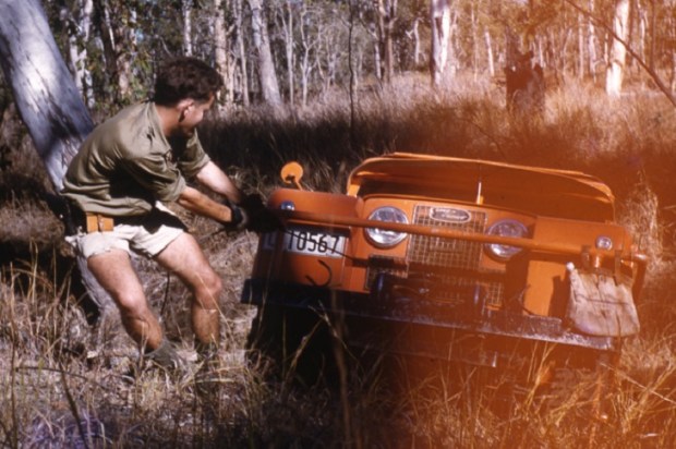
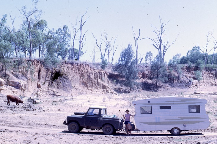
Viv had a wife and small son by then, so Utah allowed him to buy a caravan in Rockhampton and tow it to Goonyella.
Here they are crossing a creek on the track to take up the job at Utah’s Goonyella exploration camp:

The Forbes family on the Road to the Utah camp at Goonyella, 1968
And here is their son at the Goonyella camp, at the start of his long career as a civil engineer:

A Budding Civil Engineer doing Road Tests at Goonyella
Utah worked three weeks on, one week off, which we thought was fabulous. By the time I arrived, Utah had roughly located the main coal seams on the West side of the Bowen Basin from Goonyella to Blackwater. The next job was to map the strike line accurately, identify any mining problems like faults or igneous intrusions, estimate coal reserves, take bulk samples of the coal and start mine planning.
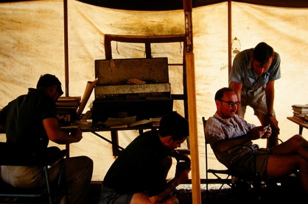
The story of the very early Utah exploration was fascinating. The field office was a caravan with a map table, a mobile drill rig, and a utility.
The drill rig moved along the public roads, and was directed where to drill by the geologist in the caravan with the best maps he could find (probably one of our BMR maps!). Logging drill holes was quite easy at this early stage. ‘White dust’ or ‘red dust’ was logged as ‘overburden’. ‘Black dust’ meant coal. If the drill rig reached its maximum depth with no black dust, the hole was abandoned and the rig was instructed to move east or west to another place where another test hole could be safely drilled.
We had no GPS instruments, no Google Maps, no mobile telephones, no electronic calculators, no notebook computers, no photocopiers, and no digital cameras – just pens, pencils, erasers, white-out ink, protractors, graduated rulers, notebooks, slide rules, log tables, aerial photographs, magnetic compasses, measuring tapes, theodolites, and the maps from those pioneering government geologists. And of course, German single-lens-reflex cameras and that wonderful new Kodachrome colour film.
Baselines for the drilling were located by compass, tape, and pegs. We tried to design these baselines to follow the line where the main dipping coal seam would intersect the surface. This would locate the line of strike of the coal. Then cross lines were located at right angles and these were used to locate drill sites to determine the dip and quality of the coal seams and hopefully identify any hidden faults or intrusions.
Something went wrong in the very early Goonyella surveying, and someone in the mine planning office in San Francisco decided that we needed to check by air the location of every drill hole. Aerial mapping was a novel idea. So we laboriously pegged down a sheet of tarred silver paper over every drill hole and the whole area was photographed from a small plane. I never did find out what was wrong but I guess it got fixed. There was little time for contemplation – we just forged ahead.
Ted Milligan was a great boss. He was a man of few words who seemed to live mainly on Scotch whiskey. He seldom gave directions to me but told me to do whatever I saw that needed doing.
We had a couple of experienced coal petrologists logging drill cores in great detail. That looked very boring – I decided I really did not care to become skilled at identifying thin seams of clarain, durain, fusain, and vitrain – all black, all types of coal, all boring. Testing coking properties was also a finicky, messy job – select a sample of coal from the core, crush the coal with a mortar and pestle, put it in a porcelain crucible, and heat it in over a Bunsen burner to see if it swelled to fill the crucible. That gave it its swell number from zero to 9. High swell was good, indicating a valuable coking coal.
But Utah did not seem to have a record in one place of every drill hole and no good cross sections or long sections of the coal seams. So I got a plain school exercise book and devoted one page to every drill hole showing logs of what was found in the drill hole. That became known as ‘Viv’s Bible’. A draftsman then drew up plans with drill locations, plus long sections and cross sections of coal seams.
As the coal seams were revealed at Goonyella we started moving south. My job then was to peg the main baseline along where we predicted the coal seam outcrop to be. I went along first with a military compass and a long measuring tape. With Judy and a toddler to help, we erected pegs to guide the dozer which followed us, clearing the scrub from the baseline. Then the baseline was pegged more permanently.
The Japanese steel mills were very interested in what Utah was finding and we organised a big dinner for a visiting delegation in a tent on site. The cook produced the best steak dinner we could organise, but we soon saw that the Japanese found that bush-cooked Aussie Brahman steak was a bit tough and chewy for lovers of tender Wagyu meat. We should have given them Hereford hamburger mince. But they went away happy and gave each of us a small electronic calculator – the first we had ever seen.
Utah and its successors went on to open a long series of coal mines stretching about 300 km along the western edge of the Bowen Basin:
- 1967 Blackwater Mine
- 1971 Goonyella Mine plus its town (Moranbah), railway, and ship loader at Hay Point
- 1972 Peak Downs Mine
- 1974 Saraji Mine
- 1976 UDC merged with General Electric
- 1982 Riverside Mine
- 1984 GE sold to BHP
- 2005 Broadmeadow Mine
- 2013 Daunia Mine
- 2014 Caval Ridge Mine
Every one of these mines was developed within or as a result of the original remarkable exploration work done by Ralph Long, Ted Milligan, and the Utah team. They also built magnificent rail and port infrastructure.

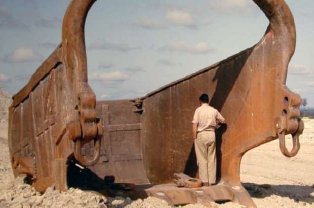
Here is a picture of the Hay Point Coal terminal originally built by Utah Development Co. The Berth #3 expansion by BMA is shown during construction at the time of the Award.
Pictured are John McRobert and his wife Lily at the presentation of an engineering achievement award made by the Institution of Engineers for the Berth #2 caisson construction. John McRobert was UDC’s Owners Representative overseeing the design of this remarkable engineering achievement.
Here is a paper by John McRobert on Coal Ports:
Unfortunately, coal ports were directed by politicians and used as a tax-gathering mechanism, so the good sense in this paper has been largely ignored.
Meanwhile, Les Thiess and Henry Horn began earth-moving from headquarters in Toowoomba in 1933. The Thiess family (Les and his five brothers) later absorbed the Horn interests and Thiess Contractors was formed. They built at least 13 major dams, including four in the Snowy Mountains, plus numerous highways, tunnels, desalination plants, and other works. They partnered with Toyota and White Trucks.
They were among the coal mining pioneers at Blair Athol, Callide, and South Blackwater and also built roads, bridges, dams, railways, tunnels, airstrips, and power stations. They poured their profits into newer and bigger equipment.
Les Thiess also lured Peabody, a huge American coal miner, and Mitsui a Japanese Trading company to form Thiess Peabody Mitsui. The first Bowen Basin coking coal exported to Japan was mined at Moura and loaded at their Barney Point coal loader in Gladstone in 1962.
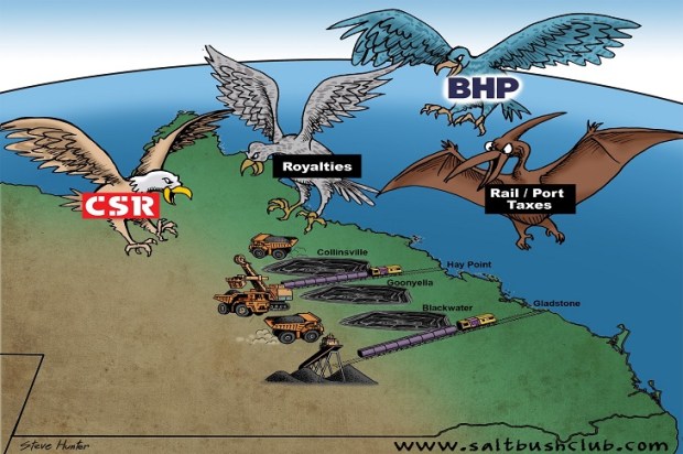
Then Thiess was taken over by CSR and later by Leighton and Utah became part of the spoils for General Electric, the Queensland government, and then BHP. And the politicians, lawyers, and bureaucrats fed well, some very well.
We all owe a debt of gratitude to the drive and innovation of these three great Bowen Basin coal pioneers: The Collinsville/Scottville Miners, Les Thiess and his brothers, and the Utah Development Company.