Here I am, back in Ecuador. Ecuadorians boast that the 6,310-metre high Mt Chimaborazo volcano protrudes 2,073 metres higher into space than Mt Everest and hence is the highest mountain on planet Earth. This is correct because of the equatorial bulge of planet Earth. Cero Latitud beer and 365 ways of cooking corn and spuds have also given me an equatorial bulge.
Ecuador is getting bigger both upwards and laterally. Blame it on the Nazca Plate. It races easterly over a hot spot beneath the Galagapos Islands at 6 cm per year. Deep below, the rocks are partially melted producing fifteen active terrestrial and submarine basalt volcanoes. The Galagapos volcanoes are not explosive, dominated by lava which flows on the land and under water and some of the islands are being pulled apart. The Galagapos Islands are still forming and increasing in area.
The movement of the Nazca Plate is resisted by the South American continent, the Peru-Chile Trench is pushed down and the top 30 km of the Pacific Ocean floor is forced under South America. These wet sediments and ocean floor basalts partially melt in the mantle and erupt as explosive andesite volcanoes along the Andes. Every time the ocean floor is pushed deeper, there is an earthquake. The largest earthquakes on Earth have been in the Andes, such as in 1960 at Valdivia, Chile. Ecuador is still recovering from the 16th April 2016 Muisne earthquake on the Pacific coast. Hundreds were killed, mainly due to the collapse of poorly-constructed multi-storey concrete buildings. As always, the poor get hit the hardest. Infrastructure was destroyed, landslides from heavy rain and shaking ground closed most roads and many bridges collapsed.
Earthquakes along the Pacific coast of South America create tsunamis that move across the Pacific at the speed of a jet aeroplane. In the mid ocean, a tsunami may only be a 10-centimetre high wave. The Japanese word tsunami means harbour wave. Centuries ago, the Japanese realised that even if they felt no earthquake, the retreat of water in a harbour heralded a tsunami and they headed for the hills. They didn’t know then that many of these tsunamis derived from offshore South American earthquakes.
Much of my recent geological work has been in the Andes of Ecuador, a beautiful developing country in a period of change from socialism to a market economy. Ecuador has used its oil revenues wisely to build highways in tortuous terrain, airports, hydro-electricity plants, universities and now a metro in the capital Quito. Where did revenues collected by Canberra in the mining boom go?
The threats to Ecuador are not war, disease, politics or the economy. Gaia could wipe out Ecuador in almost an instant. There are 34 explosive terrestrial volcanoes on continental Ecuador, most are close to Quito. Some are active such as the snow-capped Cotopaxi which has risen from 5,897 to 5,911 metres above sea level over the last few years. Mountaineers are prevented from climbing Cotopaxi at present because it is erupting.
Other volcanoes are claimed to be extinct which really means that there has been no known eruption during human times. All this means in an active tectonic belt is that these volcanoes are on the reserves bench catching their breath. They’ve erupted before and will again.
Ecuadorian volcanic eruptions don’t produce lava. They explode violently because of the sudden conversion of water to steam in rising molten rock. Such catastrophic explosions take place near the surface. Rock fragments the size of houses were blasted out and fell into volcanic ash. Volcanic ash, upon which Quito is built, is not the product of burning but it is composed of fine razor-sharp spicules of natural volcanic glass blasted out from explosions of stratovolcanoes. The landscape has been draped with ash thousands of times, the ash has not had enough time to decompose to soil and vegetation has not recovered quickly enough before the next eruption. The multiple thick ash layers covering hill and dale and the constant volcanic rumblings indicate that Quito is having a breather between catastrophic eruptions. Quito is cut by numerous narrow canyons hundreds of metres deep formed by the gouging out of faults by water. Faults form by breaking rocks and the energy produced creates earthquakes.
Crater lakes and snow-capped volcanoes have erupted many times and covered Quito with flows of boiling mud and boulders. The streets of some suburbs have eruption escape markings and real estate prices in Quito depend upon the proximity to the latest eruption.
Volcanic ash is not hot but it destroys life. Plants are covered in a thick layer and die. The lungs of humans are cut to shreds and fill with blood which cements the ash to make the lungs solid. It’s better to get flattened instantaneously with a massive boulder rather than try to breathe during an eruption. And even if you can escape the first eruption, pulsating explosions replenish the air with choking ash, roofs collapse, airports are closed, there is no visibility for escape by car, dams are filled, hydro-electricity plants clog up, crops are destroyed, particles high in the atmosphere stimulate heavy rain, flooding and landslides and infrastructure totally collapses. The biggest killer with any large volcanic eruption or earthquake is not the event itself, it is the collapse of infrastructure followed by starvation.
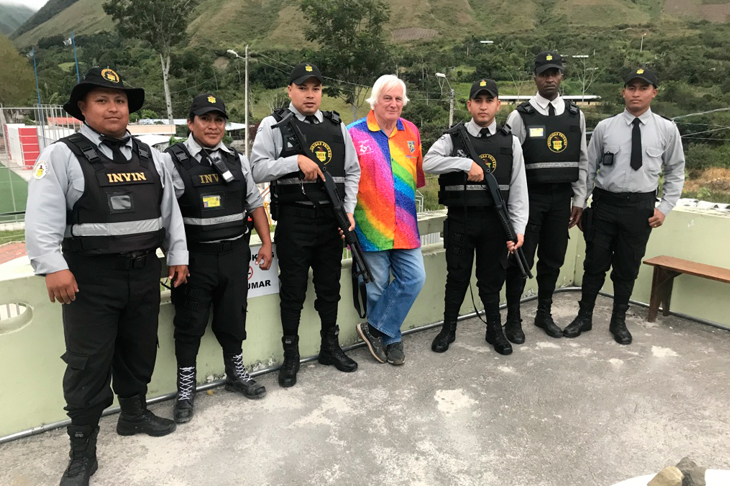
I’m currently doing geological field work north of Quito some 25 km from the Colombian border. The area is lower altitude than Quito and there are great masses of granite that were originally the molten rocks from kilometres down that fed volcanoes. These volcanoes have since been eroded. The hills are still being lifted up a few centimetres a year along deep faults producing massive landslides. Fast-flowing, sediment-laden rivers bring recycled rocks to the Pacific for the filling of the Peru-Chile Trench for yet another event of recycling.
Many visit Ecuador to see the marvels of the Galagapos, the volcanoes and the biodiversity, especially the jungle vegetation, birds and butterflies. As a natural scientist, I marvel at the massive natural processes and recognise that this is what eastern Australia would have been like some 440 million years ago.
Those humans who think that they can actually change major planetary processes by ideology, legislation and signing documents need to be humbled and get off their behinds to observe an evolving planet. Once politicians can stop a catastrophic explosive eruption, then we’ll let them have a go at stopping the alleged human-induced global warming. Don’t wait up.
Got something to add? Join the discussion and comment below.
You might disagree with half of it, but you’ll enjoy reading all of it. Try your first month for free, then just $2 a week for the remainder of your first year.